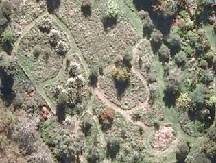
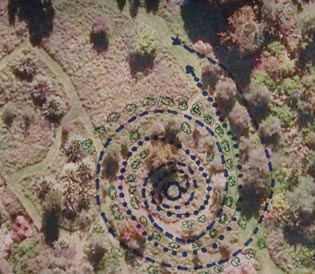
 Aerial view of part of lower terrace; the koru spirals from top right to centre.
 Pathways of the koru: --- route in; ... route out. Gaps in the avenues yet to be filled with new plantings are also indicated. Pathways of the koru: --- route in; ... route out. Gaps in the avenues yet to be filled with new plantings are also indicated. |
The area to be planted comprises 286 running metres primarily for trees and shrubs with interplanted herbs, and a further 50 metres of small plants, e.g. hebes & wharawhara (Astelias), in the centre of the koru, along the pathways leading into and out of the borrow-pit. We had hoped to do much of this in the 2010-11 season, but unforeseen circumstances prevented this and several years later the the work has yet to be done. To the left, you can see an aerial view of the site more or less as it was in 2010 and not too different from what it is now, allowing for the growth of both trees and grass. Below it there is a photo with the routes in (dashes) and out (dots) of the labyrinth, and an indication of where new shrubs and trees would be planted. Our plan was that all the existing trees, mostly olives, would be retained, but the new plantings will be of native plants, mostly if not entirely those with names inherited from Polynesia.
The entrance path is behind the olives at the bottom of the bank on the eastern edge of the terrace. It sweeps round in a wide curve, swinging round between the main pathway and the eastern end of the borrow pit, and then curving back to the edge of the borrow pit and winding down to the centre, entering the inner circle to the west. The exit path curves out from the eastern edge of the centre, winds between the entrance paths and loops tightly around the top of the borrow-pit, curving under the weeping cherry and following the inner edge of the southern outer spiral around to the exit path on the western edge of the olives.
When the new planting is under way, this page will be expanded! [Last revised September 2013] |

