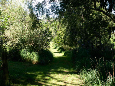
Venturing into the unknown For this phase of your notional time travel, proceed straight ahead downhill, following the path parallel to the northern boundary fence. |
This will lead you past a grove of kahikatea (another tree bearing a derivative of the Proto-Oceanic word *kahika, which you encountered with the kahikaatoa earlier in your walk).
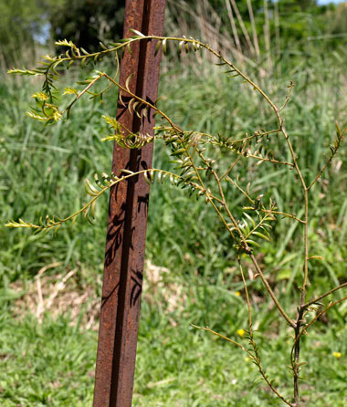
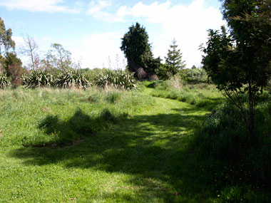
At the foot of the incline you'll come to a place where a path branches off to the left, and (at present) you can see a young tree supported by two warratahs (iron stakes). Head towards that spot.
|
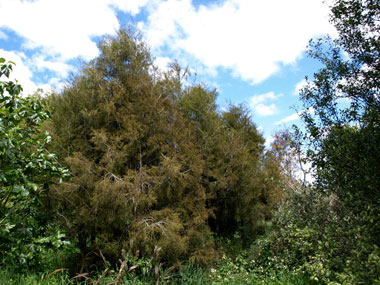
The tree supported by the stakes is another miro, a seedling given to us by Dr Ngapare Hopa in memory of Nena. It's still very young and after the extraordinarily severe winter we had last year (2009), was not looking very happy when its photograph (immediately below) was taken, although if you look carefully you can see fresh spring growth. Since it has survived thus far, we have high hopes for its future. And it is a pivotal point on this journey, whether virtual or by sentient feet.
Having reached this point, you have a variety of options for proceeding further. These are outlined in the column opposite. However, first turn around and look at the trees growing at the foot of the bank to the right of the karaka grove. Go over and have a look at the karakariki, the one with the green name-cylinder. Just remember it; its importance will be revealed at the end of your journey!
|
After you have reviewed the information and possiblities outlined in the right-hand column, you'll be ready for the next phase of the journey (or to beat a retreat). Just press the appropriate link below.
"Time travel walk" -
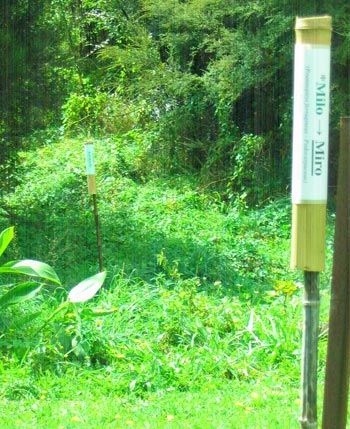
On the way to Stage 5
From Near to Remote Oceania (about 3,000 years ago)
To get to Stage 5 of our walk, we have to proceed down hill to the point marked 4b on the tour map. The ilustrated directions are in the left hand column.
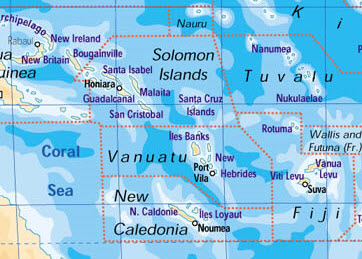
A glance at the map opposite will indicate that we have sailed quite a long way in a rather short time, from the Bismark archipelago in the top left hand corner, establishing settlements in already populated areas there and in the Solomons, discovering the previously uninhabited lslands of Vanuatu, and now going even further into the unknown and exploring, and fairly soon settling and making pottery in what is now the Fiji group, including Rotuma. Here, a new Austronesian language which we can label "Proto Central Pacific" was developed, a forerunner to the Polynesian languages and Fijian languages now spoken in the region.
The recommended route to our representative of this era is described in the opposite column. However there are several alternative routes which would allow you to proceed to the point marked 5b on the map (the southwestern corner of the garden), where another plant representing this stage of the Mäori language's evolution has conveniently appeared, thanks to a hungry bird. And if you are in a hurry, you need only proceed to Stage 5 as directed in the left hand column, from where you can get straight to Stage 6 bypassing 5b completely if you really want to.
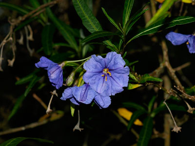
Either way, you will arrive at a poroporo tree, our Proto Central Pacific representative, a typical flower of which appears below.
|
|
|
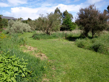
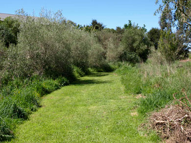
PROCEEDING TO POINT 5 (Proto Central Pacific) Just carry on from the seedling miro, following the path at the foot of the bank for about 35 metres.
You'll encounter a line of olive trees, and find the poroporo representing Stage 5 of the journey near the large green koroneiki olive to the right of centre in the picture. This is your destination.
|
|
Alternative route If you want to bypass point "5" and go to "5b" via the "river route" instead (the pre-Polynesian navigators no doubt made similar decisions when sailing into the Central Pacific), the easiest way is to back-track to the corner, and head straight towards the space between the bunyabunya tree (the one that looks vaguely like its close relative, Norfolk Pine) and the columnular cypress to the right of the pä harakeke (line of flax bushes) -- that will take you to the fence above the river and the path that leads straight to 5b. The distance from the corner to the fence is about 40 metres. More details are on the Stage 5 page (link opposite).
|
|
|
Te Mära Reo, c/o Benton Family Trust, "Tumanako", RD 1, Taupiri, Waikato 3791, Aotearoa / New Zealand  This work is licensed under a Creative Commons Attribution-Noncommercial 3.0 New Zealand License. This work is licensed under a Creative Commons Attribution-Noncommercial 3.0 New Zealand License. |